This trail is best hiked between mid-March and April if you're goal is to see wildflowers. During the early spring you can expect to see spring beauties and trailing arbutus. As the season progresses look for hepaticas, rue anemone, crested dwarf iris, yellow trillium, dwarf cinquefoil, stonecrop, Canadian violets and umbrella leaf.
Directions to Trailhead:
The hike along the Little River Trail in the Great Smoky Mountains begins from the Little River Trailhead in Elkmont. From the Sugarlands Visitor Center near Gatlinburg, drive 4.9 miles west along Little River Road to reach the turnoff for the Elkmont Campground, which will be on your left. After turning into Elkmont, drive 1.4 miles to the campground entrance. Instead of proceeding into the campground, turn left and drive another 0.6 miles to reach the parking area for the Little River Trail.
From the Townsend "Y" intersection near Cades Cove, the turnoff for the Elkmont Campground will be 12.6 miles away.
Trail Description:
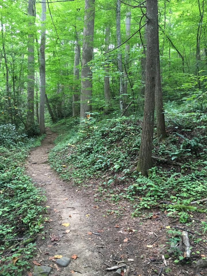
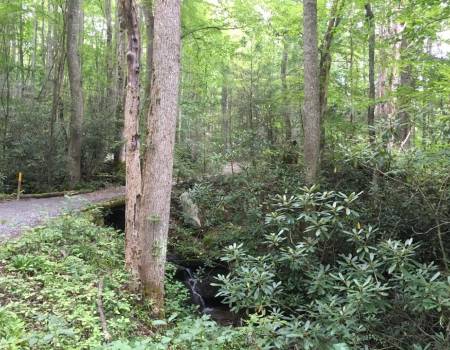
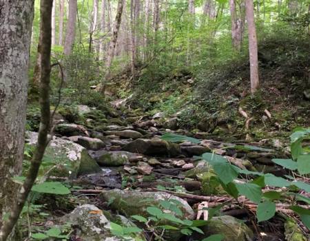
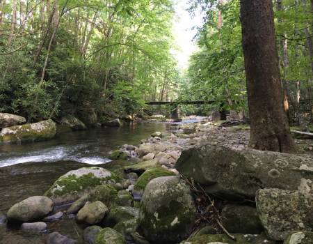
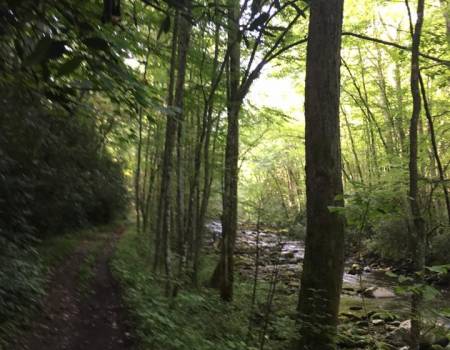
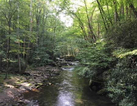
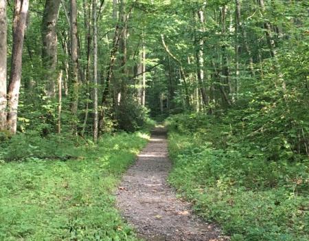
The Little River Trail ascends a gentle grade along an old gravel railroad bed that parallels the river with the same name. The river itself is a beautiful cascading stream with large boulders and several small waterfalls. The headwaters for the Little River are located along the northern slopes of Clingmans Dome, just below the Appalachian Trail. From the highest mountain in the Smokies the river flows 60 miles to reach the Tennessee River near Alcoa. The river is now on the list of Outstanding National Resource Waters, which means it has the highest degree of protection. The exceptionally clean water of the Little River supports a wide variety of aquatic life, including the eastern hellbender, a giant salamander that can measure more than two feet in length.
If you're lucky you might spot an otter in or around the stream. Between 1988 and 1990 park biologists released 14 river otters into the Little River as part of a successful effort to reintroduce the species throughout the Smokies.
Near the trailhead hikers will pass by several old cottages. Most of these former resort cottages were built in the 1920s, and were used as summer homes by the affluent from Knoxville. As of this writing the homes are in disrepair and are off limits to the public. However, in the fall of 2008, National Park Service crews completed emergency stabilization to 18 of the historic cabins, as well as the Appalachian Clubhouse. The park plans to fully restore all 19 structures so that they can be opened and viewed by the public. As part of the first phase of the Elkmont restoration project, the National Park Service reopened the old Appalachian Clubhouse for public rental in June of 2011.
At this time it's unclear as to when this restoration project will be fully completed. In 2017, however, the park began the process of removing the other 55 buildings in the area and returning those sites to their natural habitats.
The Elkmont area of the park was heavily logged from the late 1800s through 1938. In the early years logs were hauled out by ox teams, and then floated down river. Just after the turn of the century the Little River Lumber Company purchased nearly 100,000 acres of timberland along the Little River and its tributaries. They built rail lines to Elkmont, and eventually, a spur that extended all the way to Clingmans Dome. This spur would eventually become the Little River Trail. These rail lines allowed the company to extract timber at a much faster rate. After the Smokies became a national park the lumber company ceased operations in 1938, and had rolled up its tracks by early 1940.
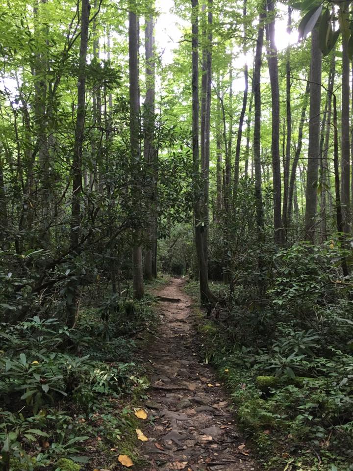
Along the lower portions of the trail hikers will stroll past several patches of rhododendron.
This trail is best hiked between mid-March and April if you're goal is to see wildflowers. During the early spring you can expect to see spring beauties and trailing arbutus. As the season progresses look for hepaticas, rue anemone, crested dwarf iris, yellow trillium, dwarf cinquefoil, stonecrop, Canadian violets and umbrella leaf.
During the summer months look for mountain mint, as well as orange and pale jewelweed.
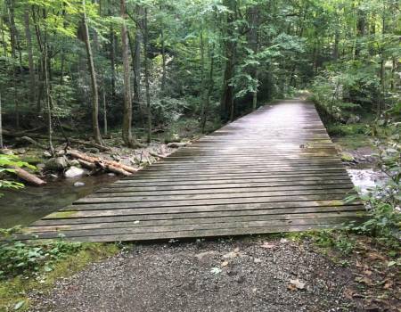
At roughly 2.2 miles hikers will reach Huskey Branch Falls, a small 20-foot cascade that tumbles into the Little River. The waterfall flows down the slope along the hill next to the trail before running underneath a small footbridge.
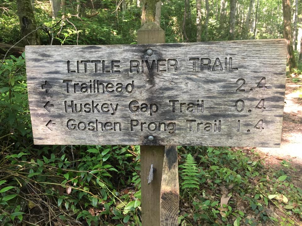
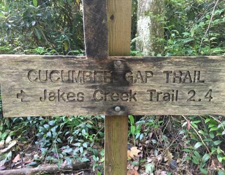
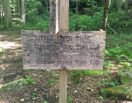
At just under 2.5 miles hikers will arrive at the Cucumber Gap Trail junction. This is the typical turn-around point for this particular hike; however, you'll have a couple of options if you wish to explore additional terrain in this part of the park. You could continue following the Little River upstream for a couple more miles (the entire trail is 6.1 miles in length), or you could extend your hike up to Huskey Gap, or you could create a loop hike by turning right and returning back to the parking area via the Cucumber Gap Trail.
Directions to Trailhead:
The Cucumber Gap Loop in the Great Smoky Mountains begins from the Little River Trailhead in Elkmont. To reach the trailhead from the Sugarlands Visitor Center near Gatlinburg, drive 4.9 miles west along Little River Road to the turnoff for the Elkmont Campground, which will be on your left. After turning into Elkmont, drive 1.4 miles to the campground entrance. Instead of proceeding into the campground, turn left and drive another 0.6 miles to reach the parking area for the Little River Trailhead.
From the Townsend "Y" intersection near Cades Cove, the turnoff for the Elkmont Campground will be 12.6 miles away.
Trail Description:
The Cucumber Gap Loop hike can be accessed from either the Little River Trailhead or the Jakes Creek Trailhead. For purposes of this hike description we will begin from the Little River Trailhead.
The Little River Trail ascends a gentle grade along an old gravel railroad bed that parallels the river with the same name. The river itself is a beautiful cascading stream with large boulders and several small waterfalls.
The headwaters for the Little River are located along the northern slopes of Clingmans Dome, just below the Appalachian Trail. From the highest mountain in the Smokies the river flows 60 miles to reach the Tennessee River near Alcoa. The river is now on the list of Outstanding National Resource Waters, which means it has the highest degree of protection. The exceptionally clean water of the Little River supports a wide variety of aquatic life, including the eastern hellbender, a giant salamander that can measure more than two feet in length.
If you're lucky you might spot an otter in or around the stream. Between 1988 and 1990 park biologists released 14 river otters into the Little River as part of a successful effort to reintroduce the species throughout the Smokies.
Near the trailhead hikers will pass by several old cottages. Most of these former resort cottages were built in the 1920s, and were used as summer homes by the affluent from the Knoxville area. As of this writing the homes are in disrepair and are off limits to the public. However, in the fall of 2008, National Park Service crews completed emergency stabilization to 18 of the historic cabins, as well as the Appalachian Clubhouse. The park plans to fully restore all 19 structures so that they can be opened and viewed by the public. As part of the first phase of the Elkmont restoration project, the National Park Service reopened the old Appalachian Clubhouse for public rental in June of 2011.
At this time it's unclear as to when this restoration project will be fully completed. In 2017, however, the park began the process of removing the other 55 buildings in the area and returning those sites to their natural habitats.
The Elkmont area of the park was heavily logged from the late 1800s through 1938. In the early years logs were hauled out by ox teams, and then floated down river. Just after the turn of the century the Little River Lumber Company purchased nearly 100,000 acres of timberland along the Little River and its tributaries. They built rail lines to Elkmont, and eventually, a spur that extended all the way to Clingmans Dome. This spur would eventually become the Little River Trail. These rail lines allowed the company to extract timber at a much faster rate. After the Smokies became a national park the lumber company ceased operations in 1938, and had rolled up its tracks by early 1940.
Along the lower portions of the trail hikers will stroll past several patches of rhododendron.
This trail is best hiked between mid-March and April if you're goal is to see wildflowers. During the early spring you can expect to see spring beauties and trailing arbutus. As the season progresses look for hepaticas, rue anemone, crested dwarf iris, yellow trillium, dwarf cinquefoil, stonecrop, Canadian violets and umbrella leaf.
During the summer months look for mountain mint, as well as orange and pale jewelweed.
At roughly 2.2 miles hikers will reach Huskey Branch Falls, a small 20-foot cascade that tumbles into the Little River. The waterfall flows down the slope along the hill next to the trail before running underneath a small footbridge.
At just under 2.5 miles you'll arrive at the Cucumber Gap Trail junction. To continue on the loop, hikers should turn right onto Cucumber Gap Trail.
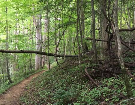
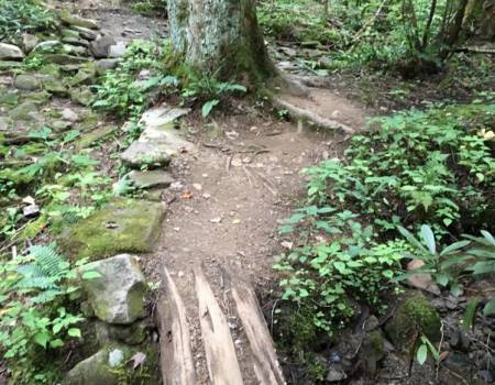
Shortly after turning onto the new trail hikers will begin a steady climb. Over the course of the next mile or so the trail climbs roughly 400 feet. This section of trail seemed to have an inordinate number of roots protruding from the ground. At least for me, it seems that there's always one or two of these obstacles that seem to reach out and trip me while I'm hiking.
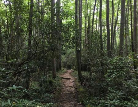
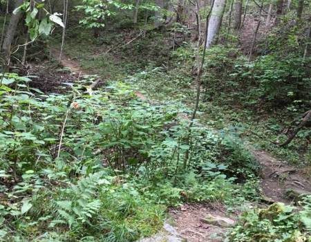
Without a cascading river flowing next to you, this new trail offers a quiet respite to the Little River Trail. There isn't anything of particular note about this route, although we did see a fair amount of wildlife. We saw a large pileated woodpecker, as well as a young doe that showed absolutely no fear as she approached us during a snack break. Further along four wild turkeys crossed the trail roughly 20 yards in front of us. We saw another turkey cross over the Jakes Creek Trail only a few feet in front of us as well.
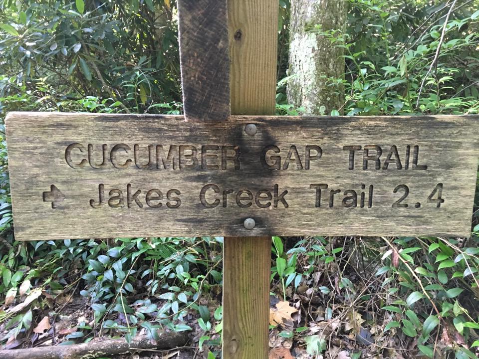
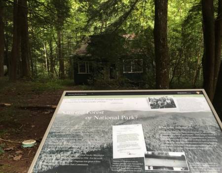
At roughly 4.8 miles you'll arrive at the Jakes Creek Trail junction where you'll turn right onto an old gravel road. If you still have the energy and wish to explore more of the park in this area, you will have the option of turning left and hiking roughly one-half mile up the trail to visit the Avent Cabin. If you wish to complete your loop hike, turn right and proceed for another three-tenths of a mile to reach the Jakes Creek Trailhead. As you walk down this old road you'll pass the remnants of several old cottages. As of this writing most of the homes along this stretch have been razed by the National Park Service. The only artifacts that remain are the chimneys, stone walls, and a few other rock structures that were once part of these homes. The former home of Colonel David C. Chapman also survives, and appears to be one of the few structures that will be preserved and fully restored by the park (see nearby photo). Colonel Chapman played an instrumental role in the establishment of Great Smoky Mountains National Park. To complete the loop and return back to your car, walk another half-mile down the paved park road to reach the Little River Trailhead.
In all, it’s 3.3 mile hike from Jakes Creek Road to Jakes Gap.
To get to the trailhead, start out at the Sugarlands Visitors Center in Gatlinburg and take Little River Road traveling west. Take the turn into Elkmont at mile 4.9 then turn left toward the Jakes Creek Trail just before you reach campground. Keep right and park near the gate.
The Jakes Creek Trail follows the old railroad route that once ran up Jakes Creek built by the Little River Lumber Company. Once past the gate, the gravel road snakes through a forest of maples and tulip trees, as well as various other Smoky Mountain plants.
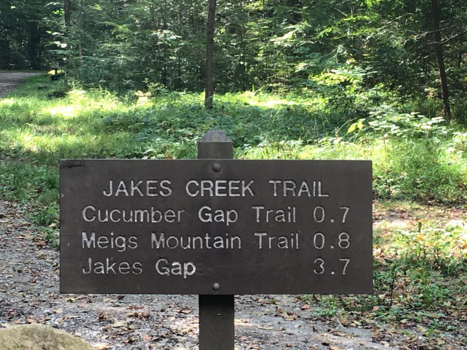
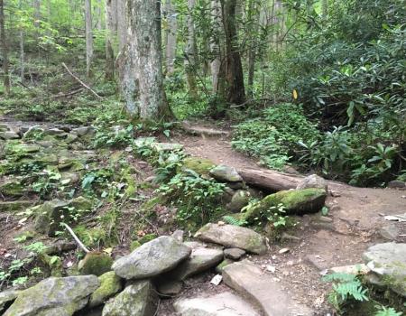
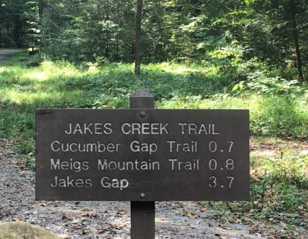
Once you’ve hiked 0.3 miles, you’ll notice that the Cucumber Gap Trail veers off to the left and at mile 0.4 the Meigs Mountain Trail takes a right. Hikers will cross Waterdog Branch 1.2 miles in by a foot log bridge. From there, the trail continues to rise before descending across Newt Prong. Be especially cautious on this portion of the trail during rainy weather.
Hikers will reach backcountry campsite No. 27 at 2.6 miles on the trail. It’s actually bordered by the trail on one side of the campsite, and the creek on the other side. This particular backcountry site gets quite a bit of use in the spring and summer months due to its close proximity to town. There’s enough room for eight campers and their horses here.
Continuing on the trail, you’ll notice that the creek soon disappears and you reach Jakes Gap at mile 3.3 – the conclusion of the Jakes Creek Trail.